

Today’s post is the eleventh in our reprint of the 1941 publication Mississippi Tourist Guide, which focused on the many attractions along Mississippi’s newly paved highways. (Check out the Intro if you missed it.)
Notice that the route described here runs from Tchula up the bluff to Lexington then Pickens and down Highway 51, while the route we know today as Hwy 49-E turns south at Tchula to run through the little communities of Thornton and Eden and into Yazoo City where it joins Hwy 49-W to head into Jackson. I wanted to find out when that section between Tchula and Yazoo City was built, so I went digging in the MDOT map archives, conveniently online, and came across a little mystery. According to this 1939 map and this 1941 map, today’s route has been designated Hwy 49-E at least since the late 1930s, while the route between Tchula and Lexington was already designated Hwy 12. In fact, as I looked closer at the map provided in the Tourist Guide, I noticed it even gives away the ruse–it shows Hwy 49-E going south at Tchula. In 1939, the Tchula-Yazoo section was still gravelled, which might have accounted for its being ignored in this tourist brochure dedicated to Mississippi’s new paved highways, but the 1941 map shows it had been paved by the time we think this publication was written. Maybe the paving was completed after this went to press, but it still seems strange to me they would have created a false route for the highway.

To see this view today: https://goo.gl/maps/rKLpr1WM9FP2
“The Choctaw Trail” (U.S. 49-E)
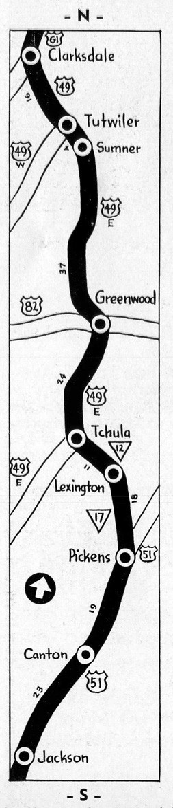 Longest continuous stretch of concrete highway in the world is the Choctaw Trail–from Memphis, Tenn., through Clarksdale, Greenwood, Lexington, Pickens, and Canton, to Jackson, Capital City of Mississippi. Branching southward from U.S. 49W at Tutwiler, the Choctaw Trail follows the eastern rim of the Delta to Greenwood, world’s largest inland long staple cotton market. At Tchula, below Greenwood, the route swings eastward into the hills and joins U.S. 51 at Pickens. This broad ribbon of concrete flows straight south over rolling country to Jackson, “Crossroads of the South.”
Clarksdale, first stop of important after leaving Memphis, is a typical Delta town, surrounded by cotton fields and gins.
Tutwiler, where the Choctaw Trail branches off from U.S. 49W, is strung along Hobson Bayou in typical Delta fashion. Grassy banks accented by willow and cypress trees make this little town a natural beauty spot.
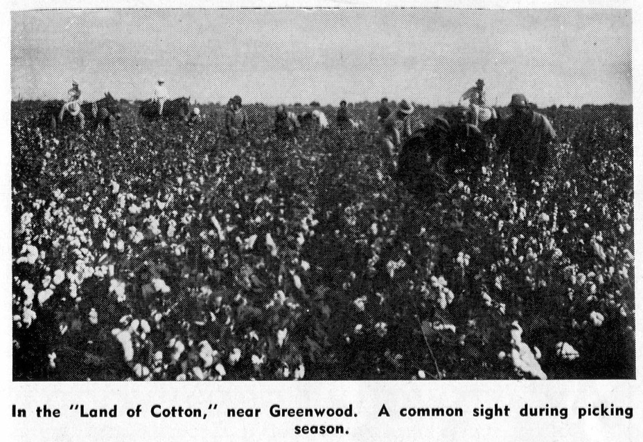 Greenwood, half-way point on the Choctaw Trail, is built around the great cotton industry of the South. As the largest inland long staple cotton market in the world, Greenwood is the center of activity for the whole surrounding area. It is a city with a glorious past that has yet to be dimmed. Many interesting sights, dating from Greenwood’s antebellum days, add to the present day appeal of this bustling community. A few of the main points of interest are the courthouse with its musical chimes, the Terry Home, the Supreme Instruments Corporation Plant, the Planters’ Oil Mill Gin and the Federal Compress Warehouse. At Greenwood the Choctaw Train junctions with the transcontinental highway, U.S. 82.
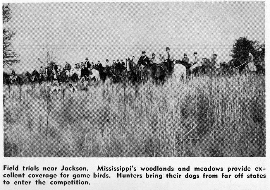
Pickens is the junction point of the Choctaw Trail with U.S. Highway 51. From here the Trail drops straight southward to Jackson, Capital City of Mississippi.

More about Highway 49-E and other Mississippi highways . . .


Categories: Clarksdale, Greenwood, Roadside

This is a fascinating series. Not sure where the “Terry home” is or was in Greenwood. But the Greenwood Chamber of Commerce ad was probably written by my mother, Sara Evans Criss, who was the secretary and creative force at the C of C from 1940 to 1950. The first picture shows the Highway 49 Underpass, largely unchanged today except for the absence of the concrete bollards. It’s an engineering Art Deco marvel worth a trip to see.
LikeLiked by 1 person
always good to get these, along with the comments from our ‘gang’. now, only three more to go, i think?
LikeLike
Very interesting. Now I see why this part of 49 wasn’t mentioned in the earlier article on 49, which didn’t mention this section that’s split between West and East. Didn’t know that about the original route either.
LikeLike