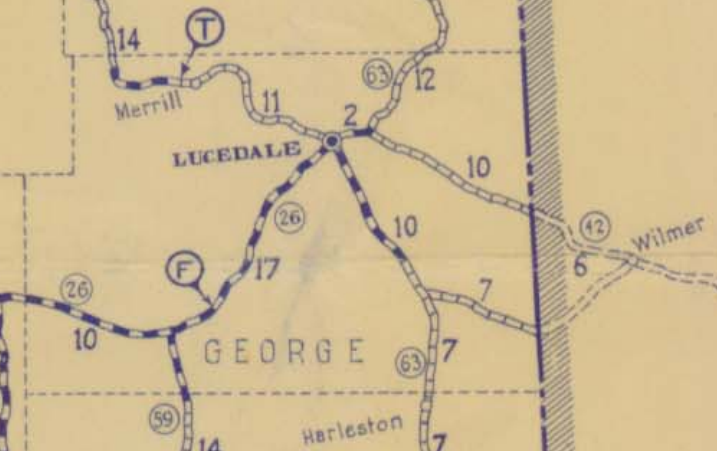
Merrill Toll Bridge indicated by “T”. Ferry at Benndale indicated by “F”. George County MDOT HWY map 1932 http://sp.mdot.ms.gov/Office of Highways/Planning/Maps/State Highway Maps Archive/HWY Map 1932 Road Map of MS.pdf accessed 1-26-2015


Merrill Toll Bridge indicated by “T”. Ferry at Benndale indicated by “F”. George County MDOT HWY map 1932 http://sp.mdot.ms.gov/Office of Highways/Planning/Maps/State Highway Maps Archive/HWY Map 1932 Road Map of MS.pdf accessed 1-26-2015

Leave a comment